
New Publication: Black Rangers in Grenada
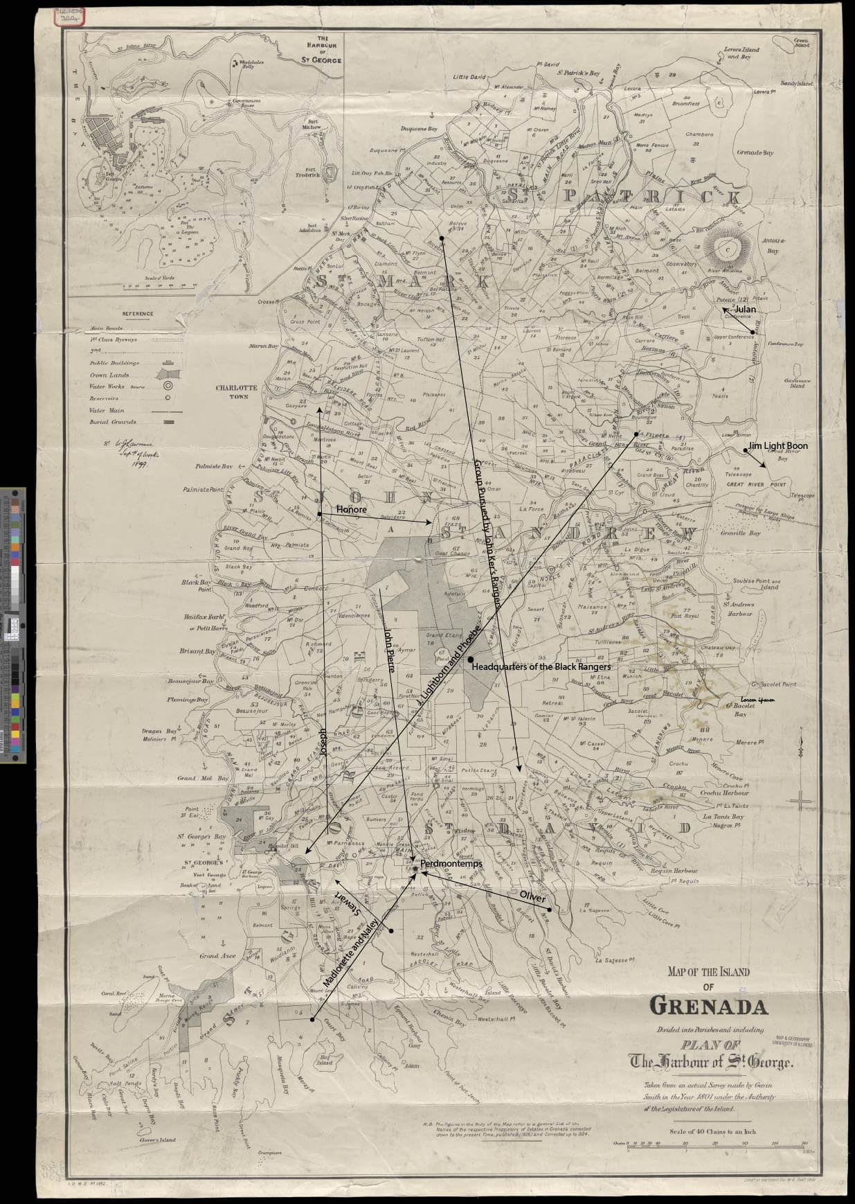
Map edited by the author using Gavin Smith, ‘Map of the Island of Grenada Divided into Parishes and Including a Plan of The Harbor of St. George. Taken from an Actual Survey Made by Gavin Smith in the Year 1801.’ Courtesy of the Map Library, University of Illinois at Urbana-Champaign.
IN THE SAME SEA Postdoctoral Fellow Heather Freund is pleased to announce the publication of her article, “Black Rangers, Enslaved Mobilities, and the Black Geography of Early Nineteenth-Century Grenada” in Slavery & Abolition.
Article Abstract: "Nineteenth-century Grenada was an island still recovering from Fédon’s Rebellion (1795–1796), which nearly toppled British rule. In its aftermath, the colonial government maintained a standing body of enslaved troops to control enslaved mobility: the Loyal Black Rangers. Their activities reveal the need for a more nuanced understanding of enslaved movement in the Lesser Antilles. This article focuses on overland marronage, showing that many bondspeople sought freedom inland rather than across the sea or in the towns. It argues that enslaved movements were facilitated by the physical geography, plantation landscape, and demography of Grenada, but hampered by the pervasiveness of the Loyal Black Rangers. It intertwines an examination of enslaved people who fled bondage with that of the Rangers who hunted them, highlighting their shared understanding of Grenada’s Black geography and the complexity of their relative positions within a slave society."
It was just published online open access and can be found here.