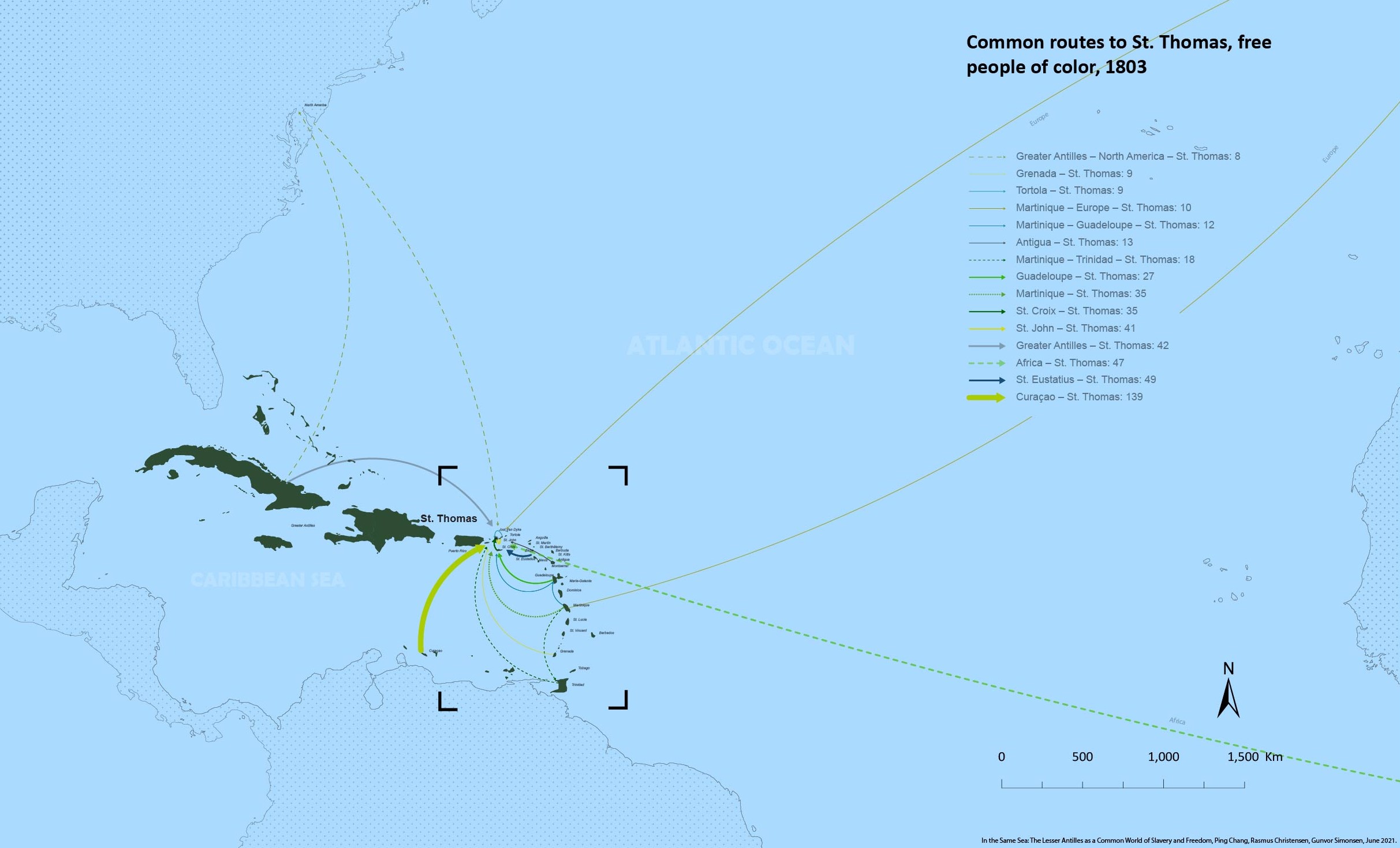
Common routes to St. Thomas, free people of color, 1803
Description
The map shows the most common routes followed by the free people of color who migrated to St. Thomas in the late eighteenth century. In this period, Danish colonial authorities worried about the growth of the population of free people of color, in particular in light of the revolutionary upheaval in the French islands. Consequently, authorities carried out a registration of free people of color, asking not merely where people were born but also where they had resided since 1789. Of the 1,353 people of color, 433 had not moved from St. Thomas since 1789.
Source
David Knight & Laurette de T. Prime, St. Thomas 1803: Crossroads of the Diaspora. The 1803 proceedings and register of the free colored inhabitants in the town of Charlotte Amalie, on the island of St. Thomas in the Danish West Indies, St. Thomas: Little Nordside Press 1999.
Rights
Please feel free to use the map with credits.
Credits and citation
“Common routes to St. Thomas, free people of color, 1803,” In the Same Sea: The Lesser Antilles as a Common World of Slavery and Freedom (supported by the European Research Council, agreement No. ERC-2019-COG 863671), Ping Chang, Rasmus Christensen, Gunvor Simonsen, June 2021, [insert link], accessed [insert date].

