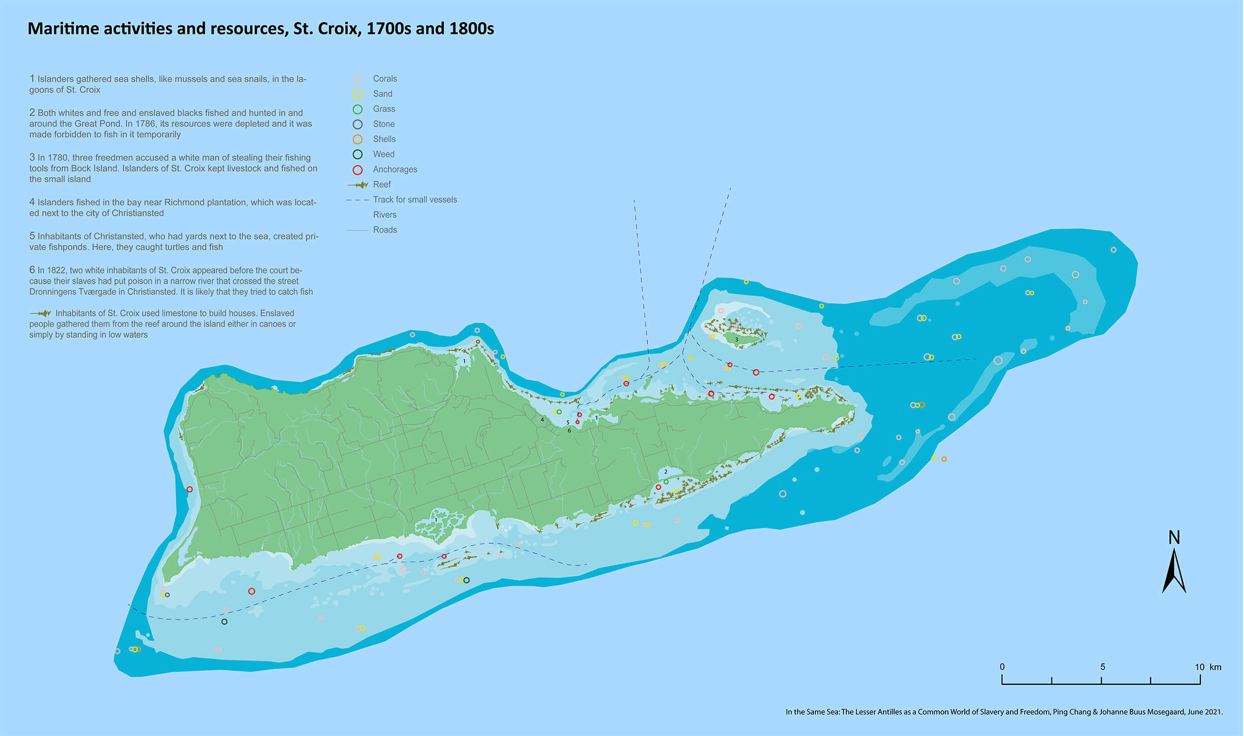
Maritime activities and resources, St. Croix, the 1700s and 1800s
Description
The map shows some of the maritime activities that took place in and around St. Croix in the eighteenth and nineteenth centuries. It also shows marine resources which could be found in St. Croix in the late 1800s. Together with depictions of different water depths and waterscapes, the historical information provided by the map allows us to imagine types and geographies of engagements that especially enslaved and poor islanders established with marine resources in the Danish West Indies.
Source
The digital map is based on the historical map Kort over St. Croix from 1894, see Danish National Archives: The West Indian Local Archives, Koloniernes Centralbestyrelse, Vestindisk Kontor. 337 36. Kort og tegninger.
References to maritime activities in St. Croix can be found in: Jensen, Niklas Thode. For the health of the enslaved: slaves, medicine and power in the Danish West Indies, 1803-1848. Copenhagen: Museum Tusculanum Press, 2012, 181ff; Danish National Archives: The West Indian Local Archives, Generalguvernementet, 2.1.4. Plakatbøger, 1786-03-31; Danish National Archives: West Indian Local Archives, Christiansted byfoged, 38.9.04. Politiretsprotokoller; West Indian Local Archives, Christiansted byfoged, 38.9.18. Politiretsprotokoller; West Indian Local Archives, Christiansted byfoged, 38.9.19. Politiretsprotokoller; Haagensen, Johan Reimart. Beskrivelser over Eylandet St. Croix i America i Vest-Indien. København: L. H. Lillies Enke, 1758, 13ff, 68.
Rights
Please feel free to use the map with credits.
Credits and citation
“Marine activities and marine resources in St. Croix, the 1700s and 1800s,” In the Same Sea: The Lesser Antilles as a Common World of Slavery and Freedom (supported by the European Research Council, agreement No. ERC-2019-COG 863671), Ping Chang, Johanne Buus Mosegaard, June 2021, [insert link], accessed [insert date].

